


It had obviously been a fairly cold night as there was a slight ground frost when I stepped out of my cabin. I’m not sure how warm my friends found the camper van! Although it had a heater we were trying to be sparing on the use of the gas cylinder.
After breakfast we drove the short distance to Wanaka airport to the east of the town. We found the flight office, booked in and waited a short while for our aircraft to arrive. After a few minutes a plane taxied up and the pilot got out and introduced himself. The plane was a Cessna 206, a six seater in a 2x2x2 arrangement. On the way to Milford Sound I sat in the middle with Nicole and Jason sat up front with the pilot. There were two German tourists in the back seats.
Before we got into the plane the pilot explained that because the approach into Milford Sound was over water the safety regulations meant that we had to wear life jackets. Not exactly a vote of confidence! However, the aircraft was cramped so quickly putting the life jackets on in an emergency would have been impossible so I can understand the need for the regulation.
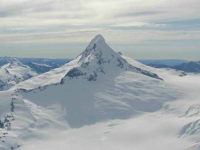
We took off and headed roughly north-east. We didn’t fly directly to Milford Sound as the sightseeing route took us to the North, past Mount Aspiring. The pilot tilted the wings so we all got a good view. He was very good, giving us great running commentary about the various things to see en route.
![]()
![]()
![]()
![]()
![]()
![]()
![]()
![]()
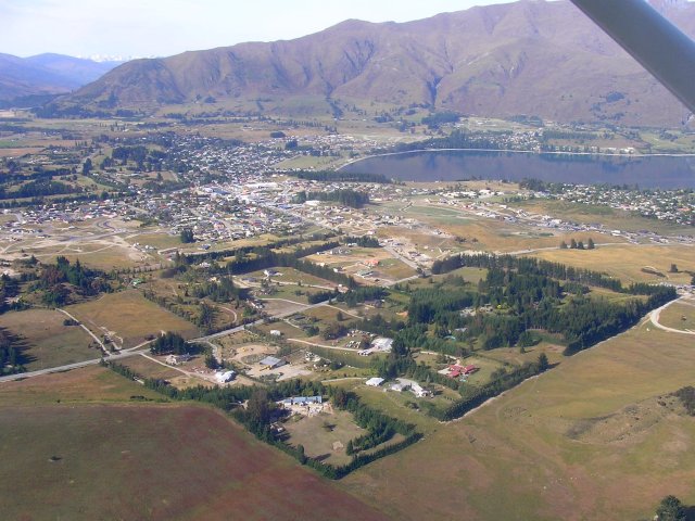
The town of Lake Hawea passed by our port wing shortly after takeoff
![]()
![]()
![]()
![]()
![]()
![]()
![]()
![]()
Mount Aspiring, looking like a mountain should!
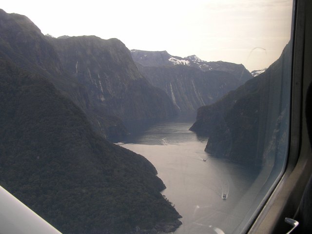
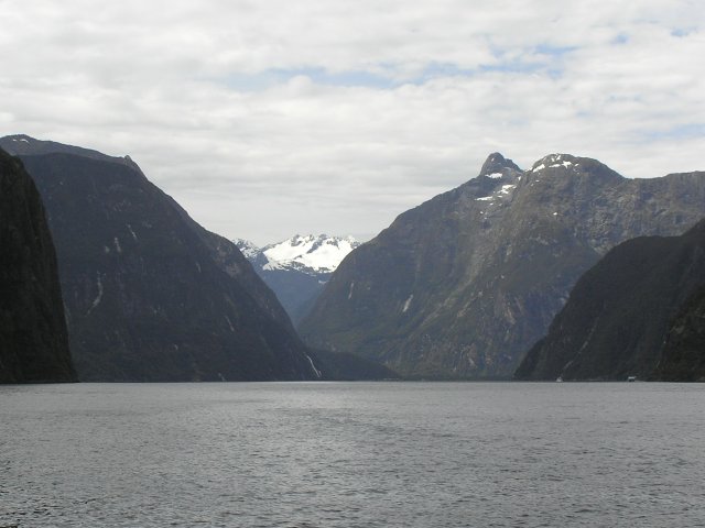
Mountains surround the airport at Milford Sound so incoming aircraft have to fly in along the fiord. This approach gave us a sneak preview of the route that our cruise boat would later take.
![]()
![]()
![]()
![]()
![]()
![]()
![]()
![]()
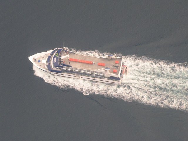
Two cruise boats out already
![]()
![]()
![]()
![]()
![]()
![]()
![]()
![]()
This one’s not too crowded
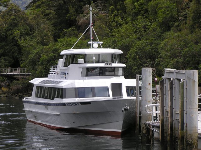
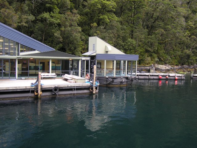
After we landed the pilot escorted us to a bus that took us the short way from the airport to the cruise ship terminal. It’s a busy building as there are a fair number of companies running sightseeing cruises out of Milford Sound and sometimes even large cruise ships come in. We were booked with the Mitre Peak tour company on a cruise that departed not long after we arrived.
![]()
![]()
![]()
![]()
![]()
![]()
![]()
![]()
Our boat, the Mitre Peak II
![]()
![]()
![]()
![]()
![]()
![]()
![]()
![]()
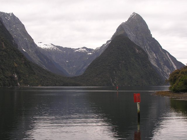
And the real Mitre Peak, named for its resemblance of a bishops hat
Milford Sound receives over 6 meters of precipitation a year and it rains on 2 out of 3 days. We were reasonably lucky as there was only a slight drizzle towards the end of the cruise although it was overcast the whole time. I stayed on the open top deck of the boat but my friends decided that the warmth of the covered main deck was a better option. The was unlimited free coffee available and several cups of that helped me to stay outside and admire the spectacular views. The captain of the vessel did a good commentary, telling us the names of the major sights and pointing out the less obvious things that we might have missed.
As the captain pointed out, Milford Sound is actually a fiord, rather than a sound. A sound is a valley formed by a river and then subsequently flooded by the sea. A fiord is formed by the erosive effects of a glacier. Remembering back to my GCSE Geography lessons it’s easy to tell the difference, river valleys are shaped like a ‘V’ whilst glacial valleys are shaped like a ‘U’.
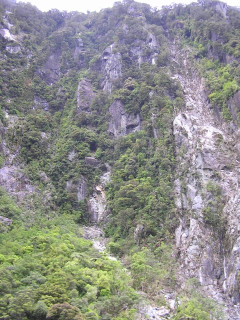
The sides of Milford Sound are near vertical cliffs but trees grow wherever there’s a ledge or a fissure. They are sustained with little or no soil by the huge amount of rain that falls in the sound. The roots of the trees interlock, helping support them. When one dies and falls it usually drags some others with it, leaving bare patches in the greenery.
![]()
![]()
![]()
![]()
![]()
![]()
![]()
![]()
The cliff faces continue down under the water for another 200 metres
![]()
![]()
![]()
![]()
![]()
![]()
![]()
![]()
Trees clinging to the cliff
Captain Cook sailed past Milford Sound in March 1770 but he didn’t see the entrance to the sound as strong winds were forcing him well out to sea. It wasn’t discovered by Europeans until the 1820’s when a gale blew a Welsh whaling ship into the shore. They feared that they were going to be wrecked but were saved when the calm waters of the sound opened up before them. The captain of the whaler was born in Milford Haven in Wales, and both the Welsh and New Zealand Milford Havens have a number of names in common - Pembroke, St. Ann's Head and in each case a Cleddau River enters its head.
![]()
![]()
![]()
![]()
![]()
![]()
![]()
![]()
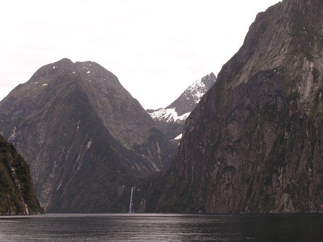
The entrance curves round behind the mountain on the left
![]()
![]()
![]()
![]()
![]()
![]()
![]()
![]()
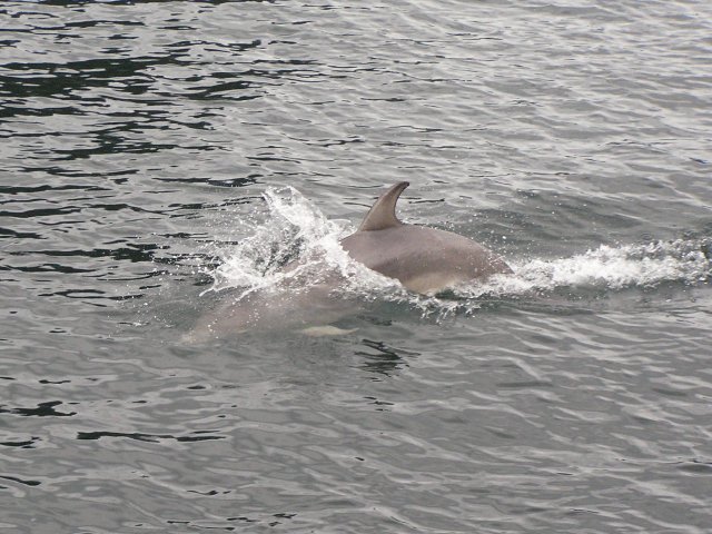
This dolphin swam alongside out boat for a while
![]()
![]()
![]()
![]()
![]()
![]()
![]()
![]()
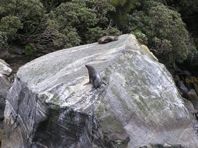
A number of seals watched us go by
![]()
![]()
![]()
![]()
![]()
![]()
![]()
![]()
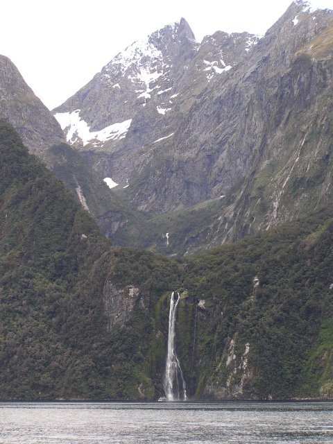
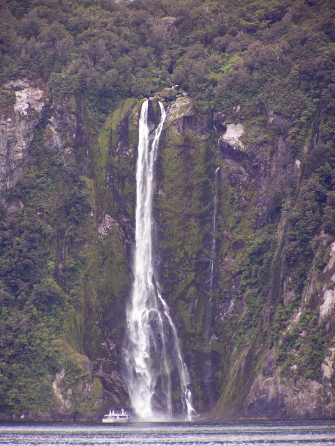
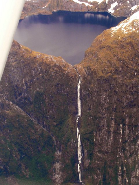
The Stirling Falls drop 145m
![]()
![]()
![]()
![]()
![]()
![]()
![]()
![]()
This boat was smaller than ours and went right into the falls. We merely went close enough to feel the spray
![]()
![]()
![]()
![]()
![]()
![]()
![]()
![]()
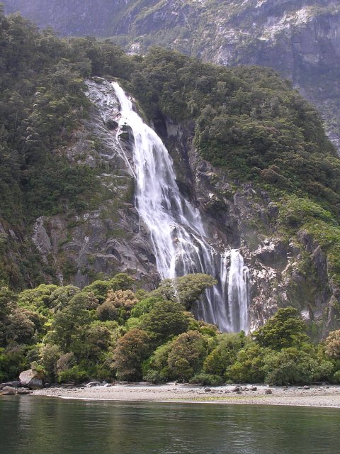
The Bowen falls are near the start and end of the cruise, close to the town of Milford Sound
Halfway along Milford Sound is an underwater observatory that the cruise stops at. It’s possible to visit the observatory and get back on a later cruise boat. In our original plan we were going to do this but because we flew in we were on a tight schedule so there wasn’t enough time to tour the observatory. It was a bit of a shame but the flight was much better than two days driving so it balanced out.
![]()
![]()
![]()
![]()
![]()
![]()
![]()
![]()
The observatory descends in a tube into the deep waters of the sound
From the underwater observatory the boat headed back to the town of Milford Sound where we found our pilot inthe cruise terminal building. He’d been off on another flight but was back in time to meet us and take us on the bus back to the airport.
For the flight back I got to sit up front next to the pilot. It was a cramped position and I had to be careful not to knock the throttle with my right knee. Rather than going directly to Wanaka we first flew south to the Sutherland falls, New Zealand’s highest waterfall with a drop of 580 meters in three stages. The falls aren’t visible from the road to Milford Sound so seeing them and Mount Aspiring were the big bonuses of taking the plane.
![]()
![]()
![]()
![]()
![]()
![]()
![]()
![]()
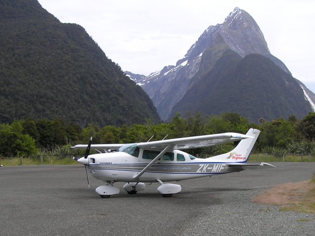
Our Cessna parked at Milford Sound airport with Mitre Peak in the background
![]()
![]()
![]()
![]()
![]()
![]()
![]()
![]()
The Sutherland Falls (and part of the wing strut!)
![]()
![]()
![]()
![]()
![]()
![]()
![]()
![]()
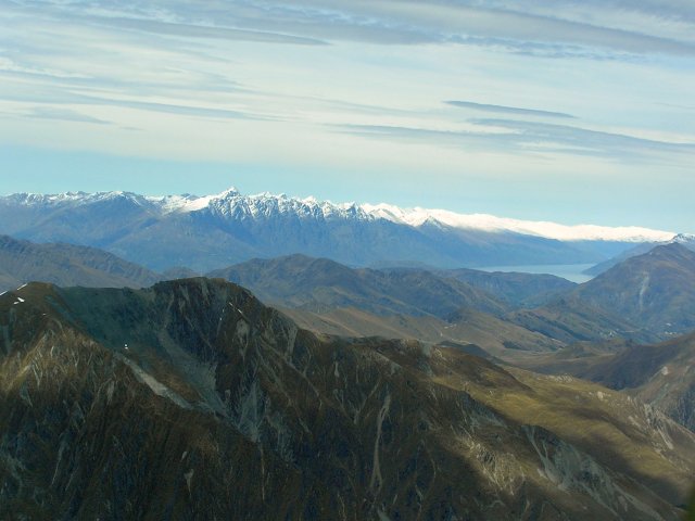
The Southern Alps from the air
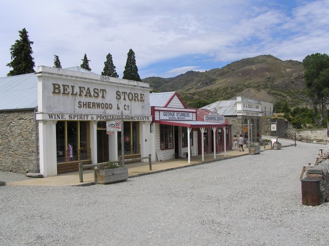
Having got back to Wanaka we headed south towards the town of Cromwell. This began as a gold mining town and became an agricultural centre after the gold rush ended. The decision to build the Clyde hydro-electric Dam and thus create Lake Dunstan meant that the older part of the town would be flooded. The more interesting of the older buildings were moved to higher ground. It had turned into a nice, warm, sunny afternoon so we enjoyed a cup of coffee and a cake outside, then we found a corner shop selling ice-cream!
![]()
![]()
![]()
![]()
![]()
![]()
![]()
![]()
The building at the end, the seed & grain merchant, is now a café where we had coffee and cake
![]()
![]()
![]()
![]()
![]()
![]()
![]()
![]()
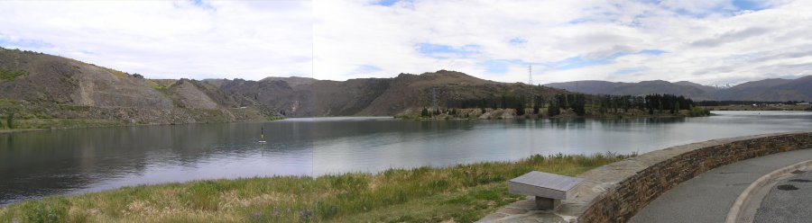
The marker buoy is above the old bridge crossing the Clutha river. Since the Clyde dam was built the bridge is now 10 meters below the surface
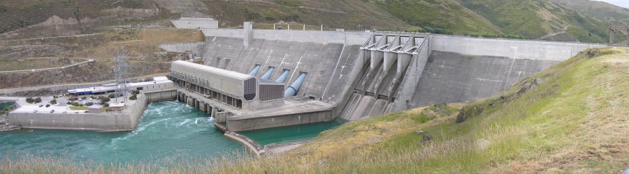
From Cromwell we drove further south to the Clyde hydro-electric Dam. This was a controversial construction project due to the large amount of land that it flooded. It was also a difficult engineering task as hills that it is anchored to turned out to be a lot less solid than the design expected. A lot of expensive stabilisation work had to be carried out to strengthen the hills before the dam could be filled. This caused the project to go massively over budget. At full output the power station can produce 432 MW but it didn’t seem too busy when we were there.
![]()
![]()
![]()
![]()
![]()
![]()
![]()
![]()
A panorama of the Clyde dam, 100 meters tall and 490 meters across
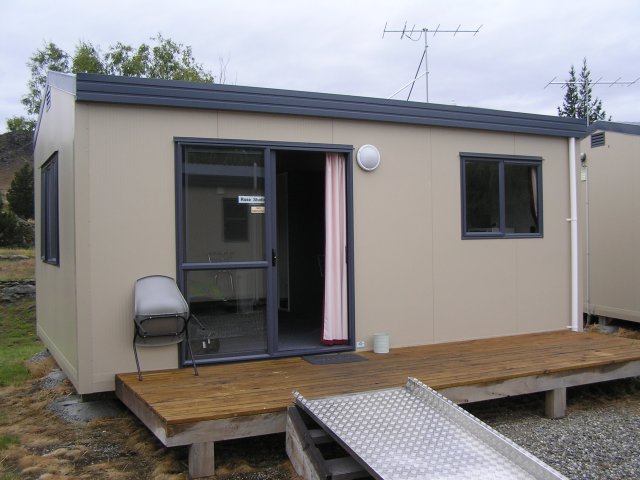
It was rather disappointing that there wasn’t a visitors centre at the dam or at the nearby town of Clyde (at least, we didn’t find one). We headed a bit further south to the town of Alexandra where we stayed the night in the Alexandra Holiday Park. This was certainly the best place that I stayed in, a cabin with bathroom and a kitchen. A great night’s sleep for $60!
![]()
![]()
![]()
![]()
![]()
![]()
![]()
![]()
My cabin at the Alexandra Holiday Park. (Photograph taken in the morning when it had started to rain)